Old Historical Maps of the Venedocia Ohio Area
All maps in this list except the first (the 1895 map) are available
in the Brumback Library. To return to this page after viewing a
map click the "Back" button on your browser.
-
- 1874 Geologic Map of Van
Wert County and accompanying text, from the 1874 Report of the Ohio Geological Survey,
Volume 2, Part 1, chapter 38. The accompanying text lists tree species native to VW county.
-
-
Part of an 1895 map showing Venedocia village and the surrounding
counties.
-
-
An 1872 map of the Venedocia area showing ownership of the
surrounding land, from a county map. The red arrow shows the
approximate location of the current Venedocia Salem Church.
-
-
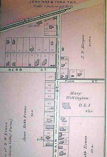
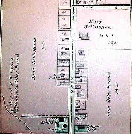
An 1886 plat map of Venedocia village. You can view the
North half and the
South half of the village as it existed in
1886.
-
-
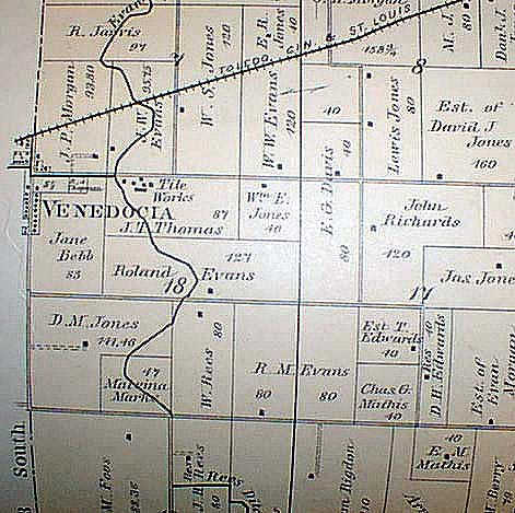
1886 map of that part of Jennings Township near the village.
Venedocia is on the left side of the map. From the 1886 county map.
-
-
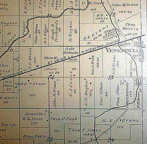
1886 map of that part of York Township near the village.
Venedocia is on the right side of the map. From the 1886 county map.
-
-
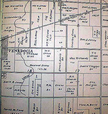
1903 map showing that part of Jennings Township near the village.
Venedocia is on the left edge. From a 1903 county atlas.
-
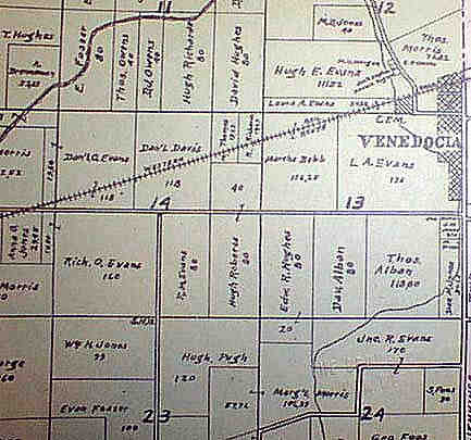
1903 map showing that part of York Township near the village..
Venedocia is on the right edge. From a 1903 county atlas.
Return to Venedocia Home Page